

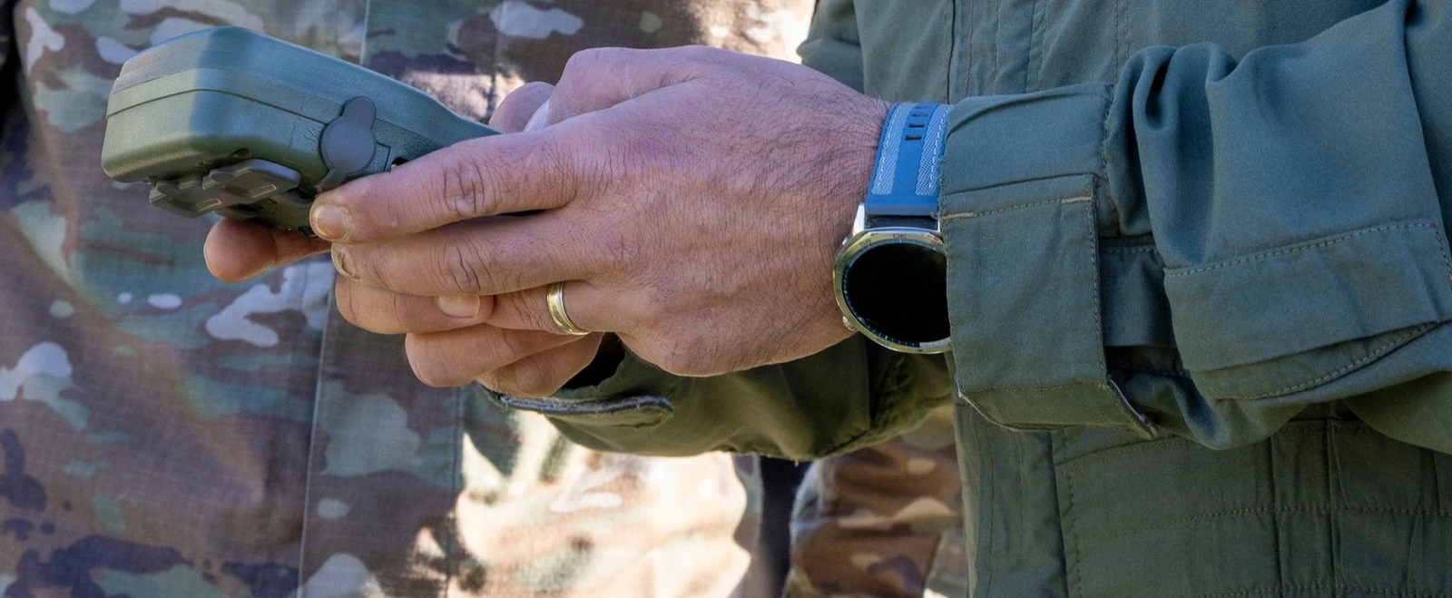
The AN/PSN-13 DAGR is a military GPS receiver providing position, velocity and time for personal navigation. It has dual-frequency reception and a SAASM security module for the military Precise Positioning Service. In the US Army, it began replacing the PLGR in December 2004. Its value after losing a vehicle lies in its independent handheld function: its own batteries, a local position display and stored navigation data. How long that display remains current, however, depends on the selected operating mode.
Handheld receiver with vehicle and data interfaces
DAGR means Defense Advanced GPS Receiver. It was designed for ground-mobile and airborne troops, while also supplying navigation data to vehicles and other connected systems. The Army’s 2005 equipment configuration includes a two-clip carrying case for attachment to load-bearing equipment. A DAGR retained by the person can operate on its own batteries after platform loss. If the receiver remains in the vehicle or independent power is unavailable, the person must determine their position by other available means.
The hardware specification cleared for publication in 2020 describes a case no larger than 16.1 × 8.79 × 4.01 centimetres, with a mass below 454 grams including batteries. The viewable display area is approximately 43 × 58.7 millimetres. Its design covers operation from −32 to +70 °C and water resistance to one metre. Four 1.5-volt AA cells provide primary power; a separate 3.6-volt half-AA cell supports memory. On a platform, DAGR can operate from 9 to 32 volts DC.
Three independent serial data ports, two RS-232 and one TIA/EIA-422, connect the receiver to other equipment. An active L1/L2 antenna connection and an input for differential GPS corrections are also provided. The data interfaces can pass position and time onwards. DAGR itself is a navigation receiver; sending information to recovery forces requires a communication means actually available to the person. A GPS survival radio instead combines navigation and radio transmission in the carried set.
What dual-frequency reception and SAASM provide
The classic DAGR receiver tracks L1 and L2 simultaneously. On L1, it processes C/A and P(Y) codes; on L2, it processes P(Y) code. In the USMC’s 2011 configuration, twelve receiver channels and “All in View” tracking process the available satellites together. SAASM, the Selective Availability Anti-Spoofing Module, permits use of the protected military service. The receiver must be appropriately prepared for it. The hardware designation alone does not establish a valid key or operating state.
The 2020 position specifications separate the methods: the 95-percent horizontal position error limit is below 6.7 metres for PPS and below 2.4 metres for DGPS. DGPS requires its correction input. When a previously integrated receiver is carried alone, the user needs to check whether those corrections remain available. The estimated horizontal error display is therefore part of assessing position. The receiver also has integrity monitoring and multipath-resistance functions, intended to prevent a received reflection being treated without qualification as a direct satellite path.
Continuous, Fix and Standby provide different information
For the AN/PSN-13 in the USMC’s 2011 configuration, Continuous is the normal mode with external power, while Fix is the initial mode on batteries. Both obtain satellite data, but then proceed differently. The selected mode appears on the Present Position page. For an isolated person, it matters as much as the coordinates: it shows whether the receiver continues tracking or now provides only stored information.
| Mode | Satellite tracking | Meaning during movement |
|---|---|---|
| Continuous | Continuous position, velocity and time solution; highest power consumption | New position and movement values are calculated continuously while reception permits. |
| Fix | Obtains a current solution, then automatically enters Standby | A further fix must be initiated to determine a new current position. |
| Standby | Reduced power; no satellite acquisition or tracking | Stored data remains usable, but does not represent a continuously updated position. |
To change mode, the Present Position page is accessed by holding POS/PAGE. After MENU, SELECT OP MODE is highlighted and opened with WP/ENTER. The desired mode is then selected and confirmed with WP/ENTER again. Returning to the position page shows the selected state. A person moving after a single position fix must not read the retained coordinate as a tracked position. Keeping the receiver in Continuous throughout movement provides ongoing updates but uses more energy.
Average, Time Only, Rehearsal, Test and Off are other modes. The commanded self-test checks the keypad, lighting, contrast and display, among other functions; the full test takes approximately four minutes. Afterwards, the receiver enters Standby. A completed self-test and the mode required for navigation are therefore separate states. The person needs to check the actual reception mode again after the test.
A visible coordinate can still be the previous position
At startup, DAGR initially shows the satellite page. Once a current position is acquired, it displays the Present Position page. If position fields continue blinking between black and grey, the receiver is not tracking satellites or has not yet acquired a current position. A newly determined position appears as solid black text. Black signal bars on the satellite page indicate tracked satellites; “NAVIGATING” identifies an active navigation solution.
The Present Position page combines coordinates with operating mode, datum, estimated horizontal error, a quality indication (figure of merit), altitude, speed, track and time. Freshness, mode and error indication are therefore read together before reporting a position or marking a waypoint. A stored position from an earlier halt remains historical location information if the person has since moved.
The receiving antenna needs a usable view of the sky. DAGR retains internal time to acquire satellites more quickly after startup. The 2020 specification distinguishes a hot start below ten seconds, a warm start below 90 seconds and a cold start below 100 seconds. These classes refer to the receiver’s initial information state. In a cold start, it begins without time, position or almanac. Obstructed reception does not produce a new location during that process, even when stored position fields are already visible.
What maps, waypoints and warning areas mean inside the set
The 2020 specification provides 999 waypoints and five moving waypoints, with up to 32 megabytes for moving-map displays. Maps and data can be transferred from a computer or another DAGR. The pages distinguish Present Position, Situational Awareness, Navigation Pointer, Image Viewer and satellite status. A map display requires the appropriate map set to be loaded. The navigation pointer can use an existing waypoint without turning it into a current situation map obtained by radio.
GO TO WP uses direct navigation to the selected waypoint. The Nav Pointer displays the user’s ground track, target azimuth and distance. This is calculated geometry between position and destination. It does not make a road, obstacle or enemy-observed ridgeline into a safe route selected by the receiver. During isolation, the type of destination data also matters: a previous personal location, a specified rendezvous point or a manually entered destination.
Coordinate format and geodetic datum are selected separately. The hardware supports 30 predefined coordinate systems and 233 predefined datums, with additional user-defined entries. An MGRS grid reference alone does not identify the receiver’s datum setting. For onward communication, the receiver format must match the map and receiving station.
Alerts can be prepared using existing waypoints: Anchor indicates leaving a circle, Hazard entering a circle, Buffer entering a rectangle and Corridor leaving a rectangle. These functions compare the user’s position with stored geometry. They detect neither new hazards nor an obstacle’s actual extent. A prepared warning area needs a sufficiently current personal position and a correct stored boundary.
Battery endurance and software distinguish the variants
The 2020 hardware specification assigns more than 14 hours of continuous operation to four AA cells, with typical power consumption around one watt. The Army’s 2005 configuration gave 19 hours. These values belong to their respective specification states. The person can directly influence energy use by choosing between continuous tracking and individual fixes.
AN/PSN-13 and AN/PSN-13A also need to be distinguished by receiver and software identity. In 2009, the -13 used software line 984-2461-016, while the -13A used 984-3006-006. Changes then included improved handling of reflected signals, additional Buffer alerts and a better low-battery warning; earlier improvements included an updated world magnetic model. Software versions therefore change concrete display and processing functions. Those historical identifiers are not current update instructions.
By April 2026, initial deliveries of BAE Systems’ M-Code successor NavGuide were underway; DAGR production had ended, with support for existing DAGR receivers continuing. NavGuide is designed to reuse existing DAGR mounts, cables and accessories. Its new M-Code reception replaces DAGR’s older SAASM receiving technology while allowing existing platform connections to be retained.
The appearance of U.S. Department of War (DoW) visual information does not imply or constitute DoW endorsement.