

GPS stands for Global Positioning System, the United States’ global satellite navigation system. It supports position and time determination and is used for both civilian and military navigation.
How the receiver determines position
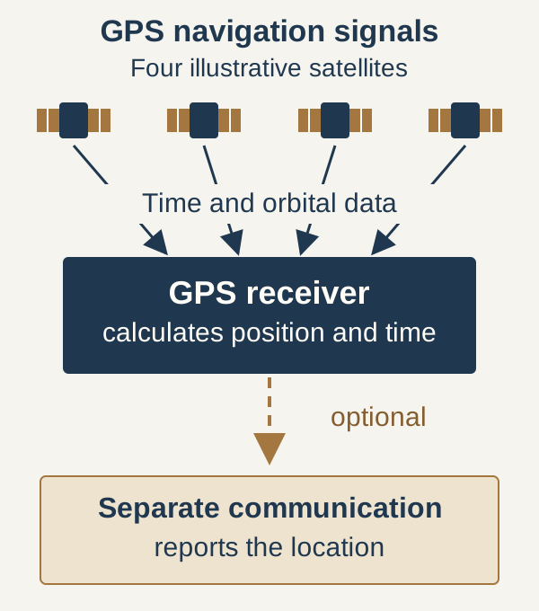
Satellites transmit time and orbital data. The receiver derives range measurements from signal travel times and uses the satellite positions to calculate its own location. The usual three-dimensional solution requires at least four satellites: the receiver’s clock error must be resolved alongside the three spatial coordinates.
Calculating and reporting a location
GPS navigation signals travel from the satellite to the receiver. The device calculates its position locally. Passing that location to another party requires an additional communication function. A smartphone, for example, can share the calculated position through an internet-connected app.
A successful GPS calculation therefore does not notify friendly forces of an isolated person or initiate recovery. Reporting the location additionally requires an available communications device, a reachable counterpart and the prescribed contact procedure. The position must refer to the person's present location; after further movement, the earlier coordinate describes a place already left. If no report can be transmitted, GPS remains a personal navigation aid while protection, sustainment and evasion still have to be managed independently.
GPS and GNSS
Global Navigation Satellite System, GNSS, is the broader category. Other examples alongside GPS include Galileo, GLONASS and BeiDou. Capable receivers can combine signals from several constellations.
Field use and limitations
The French SERE B and C profiles include GPS alongside maps and a compass for navigation and movement.
Buildings, terrain masking and trees can affect reception. Reflections from walls, the arrangement of visible satellites, atmospheric conditions and radio interference also affect position determination. The map display uses its own data: an incorrectly drawn road or outdated map entry can make the display misleading even while GPS reception is working.
For movement, the displayed position is compared with terrain features actually known and the route already travelled. If the person stands beside a clearly identified watercourse while the display places them elsewhere, the next leg is not based on that point. Reception conditions and the map display are checked first, and the last reliably known location is kept separate from the doubtful display. Without an independent location reference, the position remains uncertain; extra decimal places do not make it more reliable. Better reception may improve the calculation but may require a more exposed position. That move therefore has to fit the terrain, threat and the person's mobility.